

UDC 581.5: 528.94
Bazha S.N., Andreev A.V., Bogdanov E.A., Danzhalova E.V., Petukhov I.A., Rupyshev Yu.A. SPATIAL DATABASE OF ECOSYSTEM OF THE BAIKAL BASIN // Arid ecosystems. 2022. V.28. № 3 (92). P. 14-22. | PDF
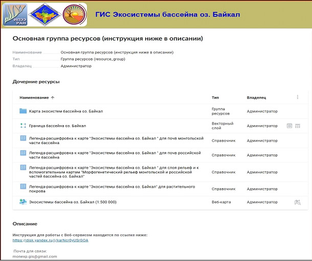
We created a new dataset of spatially interpolated ecosystems for the Baikal Basin at a middle spatial resolution (scale of 1:500 000), divided into 71 mesocombinations of plant communities and their anthropogenically transformed derivatives. A digital layer-map divided into 31 types of morphogenetic types of relief was developed to display the spatial variability of the selected geobotanical units. The layer-map for the soil cover was obtained using interpolation of various published thematic data, and was supplemented with archival and long-term data collected from the field studies. The prepared database was added by a very high resolution spatial data of ecosystems and their anthropogenic disturbance for 9 model polygons (more than 1:200000), key sites (1:5000‑1:10000), and 1,757 geobotanical descriptions where created by the authors earlier. The 5.1 GB spatial database is a mapping web service located at https://mon-exp.nextgis.com/resource/. It is intended for open use on any personal computers, workstations, laptops, tablets, Smart phones running Windows and Android, including mobile ones with Internet access.
Keywords: database, GIS, ecosystems, Baikal basin, ecological mapping.
Financing. The research was carried out within the framework of the Scientific Program of the Joint Russian-Mongolian Integrated Biological Expedition of the Russian Academy of Sciences and the Mongolian Academy of Sciences, as well as with the support of the Russian Foundation for Basic Research Grant No. 17-29-05019 «Dangerous degradation processes and their role in the formation of anthropogenically transformed landscapes in the Baikal basin».
DOI: 10.24412/1993-3916-2022-3-14-22