↓
 

ISSN 1993-3916

Arid Ecosystems

The “Arid Ecosystems” journal was organized by the decision of General Biology Division of the Russian Academy of Sciences.

  •  Home
  • Preprint
  • Contacts
  • Open Access 
  • Archive
    • Issues 1990s
      • Issues for 1995
      • Issues for 1996
      • Issues for 1997
      • Issues for 1998
      • Issues for 1999
      • Issues for 2000
    • Issues 2000s
      • Issues for 2001
      • Issues for 2002
      • Issues for 2003
      • Issues for 2004
      • Issues for 2005
      • Issues for 2006
      • Issues for 2007
      • Issues for 2008
      • Issues for 2009
      • Issues for 2010
    • Issues 2010s
      • Issues for 2011
      • Issues for 2012
      • Issues for 2013
      • Issues for 2014
      • Issues for 2015
      • Issues for 2016
      • Issues for 2017
      • Issues for 2018
      • Issues for 2019
    • Issues 2020s
      • Issues for 2020
      • Issues for 2021
      • Issues for 2022

Архив рубрики: article-1-2022

Навигация по записям

← Предыдущие записи

TRENDS IN HYDROTHERMAL INDICATORS OF THE STEPPES OF SOUTH-EASTERN TRANSBAIKALIA IN THE CONTEXT OF CLIMATE WARMING

Arid Ecosystems

Davydova N.D. TRENDS IN HYDROTHERMAL INDICATORS OF THE STEPPES OF SOUTH-EASTERN TRANSBAIKALIA IN THE CONTEXT OF CLIMATE WARMING // Arid ecosystems. 2022. V.28. № 1 (90). P. 3-10 . | PDF

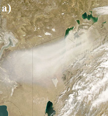
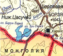
One of the problems of the development of society on Earth was climate change due to the increase in the temperature of the surface layer of air, which for different regions was and remains not equal. The analysis of long-term data on air temperature, atmospheric precipitation and humidity of deep-frozen powdery-carbonate chernozems of the Onon-Argun steppe of South-Eastern Transbaikalia is carried out. It is shown that the next dry period of 1999-2020 differs from the previous one by a significant increase in temperature and an ambiguous annual amount of precipitation. According to these indicators, it is divided into two parts: very dry warm and wet very warm. In the driest period (2001-2011), the moisture reserves in the soils were mostly at the level of withering humidity and below. In nature, there were such catastrophic phenomena as the widespread drying of stands of trees, the disappearance of lakes, including a large one-Barun-Torey. Since 2012, the amount of precipitation has increased, but has had little effect on the soil moisture reserves and the replenishment of the water volume in the lakes. As a result, by 2018, the water area of another large lake of the Torey depression – Zun-Torey-disappeared. The bottoms of the dried-up lakes turned into soda-sulfate sodium and soda- chloride-sulfate sodium salt marshes. In the terrestrial grassland of the steppes, the introduction of xerophilic species into the communities was observed, as well as a decrease in its height and density. The amount of aboveground plant mass decreased by 1.5-2.0 times.

Keywords: global warming, Onon-Argun steppe, atmospheric precipitation, air temperature, humidity, soil, lake drying, vegetation, xerophilic species, stand of trees.

Acknowledgement. The author is grateful to the head of the Borzya meteorological station, L.I. Karpikova, hydrologist O.V. Perminova and all the employees who worked in different years for their long-term assistance in the selection of materials, consultations, understanding and warm friendly attitude, as well as Ph.D. L.V. Dudareva, who took a direct part in the formation of the Chemical Analytical Center of the Institute of Geography of the SB RAS and its accreditation, the development of the instrument base and the receipt of KHA data.

Financing. The work was carried out at the expense of the state assignment of the IG SB RAS, state registration No. AAAA17-117041910171-7, “Spatial and temporal patterns of the material state of the landscapes of Siberia in changing environmental conditions”.

DOI: 10.24412/1993-3916-2022-1-3-10

CONVECTIVE AEROSOL REMOVAL IN DESERT ZONES AS A FACTOR OF AIR TEMPERATURE RISE

Arid Ecosystems

UDC 551.511.61; 551.513.22

Tleumuratova B.S., Narymbetov B.Zh. CONVECTIVE AEROSOL REMOVAL IN DESERT ZONES AS A FACTOR OF AIR TEMPERATURE RISE // Arid ecosystems. 2022. V.28. № 1 (90). P. 11-19. | PDF

The article discusses aerosol pollution of the atmosphere in the Southern Aral Sea region as a factor of climate change in this region. The main causes of pollution are wind and convective removal of soil particles from the underlying surface. The differences between these two types of emissions are shown. Since the effect of wind removal of aerosol from the drained bottom of the Aral Sea on the regional climate has been studied in our previous studies, in this paper, only convective removal of soil microparticles from desert surfaces is considered (for the first time) as a factor of increasing summer air temperatures in the Southern Aral Sea region. The paper presents the results of calculations of the mass concentration of aerosol in the surface layer of the atmosphere caused by convective flows. The quantitative assessment obtained by mathematical modeling methods showed the significance of convective aerosol removal in the Southern Aral Sea region, which increases the aerosol concentration to 1.2 mg/m3. As a result of numerical experiments, the dependence of the air temperature increase by convective removal of soil particles on the aerosol dispersion in the range of 0.3-5°C was revealed. The absence of precipitation in the Southern Aral Sea region in July-August, which counteracts the convective removal of soil aerosol by leaching the aerosol from the atmosphere and wetting the underlying surface, ensures a continuous flow of aerosol particles into the atmosphere, which increases the climate-forming effect of the process under consideration.

Keywords: convective removal, aerosol, near-surface air temperature, climatic forcing, Southern Aral Sea region.

Acknowledgement. The authors are grateful to Dr. B.F. Abdurakhimov, Professor of the Department of Applied Mathematics and Computer Analysis of the National University of Uzbekistan for the hypothesis expressed in a private conversation about the possibility of climatic forcing of air temperature by convective emission of particles of the heated underlying surface.

Financing. The research was carried out within the framework of the state task «Research by methods of mathematical modeling of the dynamics of ecological and climatological processes in the Southern Aral Sea region».

DOI: 10.24412/1993-3916-2022-1-11-19

INFLUENCE OF CLIMATE CHANGE ON SOIL DEGRADATION IN ARID ZONES OF THE VOLGA REGION

Arid Ecosystems

UDC 631.434.52:504.123(470.4)

Gubarev D.I., Levitskaya N.G., Derevyagin S.S. INFLUENCE OF CLIMATE CHANGE ON SOIL DEGRADATION IN ARID ZONES OF THE VOLGA REGION // Arid ecosystems. 2022. V.28. № 1 (90). P. 20-27. | PDF

The aim of the research was to establish the impact of climate change on the processes of soil degradation and desertification in the arid zones of the Volga region. The material for the research was the observational data for 1971-2020 on 20 meteorological stations, as well as the results of soil-ecological and hydrogeological monitoring at research stations of the Federal State Budgetary Scientific Organization «Federal Center of Agriculture Research of the South- East Region» in the prevailing soil and climatic zones on the territory of the Saratov region (forest-steppe, steppe, dry steppe and semi-desert). Identified signs accompanying aridization, desertification and land degradation differentiated by natural zones. In particular, the average annual air temperature increased, compared with the climatic norm, by 1.0-1.2°С, the greatest increase was observed in August (by 2.0-2.2°С). The average temperature of the soil surface during the warm period increased by 1.1-1.5°C. The risks of severe atmospheric droughts during the entire growing season increased throughout the entire territory, most noticeably in the semi-desert zone (from 55 to 82%). The amount of precipitation in the spring increased by 10-25%, and in the summer – decreased by 23-30%. The boundaries of the semi-desert zone have shifted to the north and northwest. The tendency of changes in the hydrological regime of zonal soils from non-leaching to periodically leaching in 20-40% of years is outlined. The values of the aridity indices of the territory, calculated for the period from 2001 to 2020, increased in comparison with the climatic norm for 1971-2000 by 3-6%. This is an indicator of an increase in climate aridity during its current warming. As a result, high rates of dehumification (decrease in the relative humus content by 21-35%) and changes in the structural state of the arable layer and grain size distribution (decrease in water-resistant aggregates >0.25 mm from 39 to 31.8% and the absolute content of physical clay by 7.5%). At the same time, there is an increase in the mineralization of groundwater from 2500 to 7000 mg/l, as well as an increase in the content of toxic salts in the soil solution. Thus, the content of Cl—, SO42— ions in the places of replenishment with groundwater increased from 0.27 to 0.56 mg/eq. and from 0.27 to 13.27 mg/eq. respectively. The cation values also increased: Ca2+ – from 0.30 to 4.41 mg/eq., Mg2+ – from 0.12 to 5.59 mg/eq., The sum of K+ and Na+ – from 0.09 to 0.28 mg/eq. In the lowered elements of the relief, the development of processes of local salinization and waterlogging is noted.

Keywords.Climate change, aridization, drought, degradation, salinization.

Financing. The article was made within the state assignment No. 0751-2019-0008 “To develop theoretical foundations for structuring agricultural landscapes, adapting them to climatic and geomorphometric features of the territory in order to preserve and optimize the use of land resources to obtain an economically reasonable level of quality agricultural products”.

DOI: 10.24412/1993-3916-2022-1-20-27

EVALUATION OF CHANGES IN NATIVE VEGETATION COVER OF DUST SOURCES IN THE SOUTHWEST OF IRAN UNDER DIFFERENT IRRIGATION SYSTEMS AND RAINFALL PATTERNS IN SEEDLING CULTIVATION AREAS

Arid Ecosystems

UDC 633.2.033; 633.2.032; 633.2.038

Dinarvand M., Arami S.A., Sarab S.A.M. EVALUATION OF CHANGES IN NATIVE VEGETATION COVER OF DUST SOURCES IN THE SOUTHWEST OF IRAN UNDER DIFFERENT IRRIGATION SYSTEMS AND RAINFALL PATTERNS IN SEEDLING CULTIVATION AREAS // Arid ecosystems. 2022. V.28. № 1 (90). P. 28-41. | PDF

Efficient use of rainfall and water storage has fundamental importance for rehabilitation and improving rangelands in arid areas. In this study, we evaluated the changes in the natural vegetation cover of three regions (dust centers) of the south and southeast of Ahvaz under different irrigation systems and rainfall patterns following seedling cultivation. Observations were made on five 100-meter transects, each 50 meters apart, which were systematically established in the three selected areas. Around 180 fixed plots were installed along transects. In the two growing seasons of spring and autumn from 2018 to 2020, the coverage of native species was recorded. The Simpson and Shannon and dominance diversity indices were estimated using the PAST software. The results showed that in the selected areas, various irrigation methods along with rainfall caused significant positive changes in vegetation cover, the number of species, and diversity from 2018 to 2020. The results indicated a significant difference between the average dominance index, Simpson and Shannon indices, and vegetation cover, as well as the number of species in different years. This study has identified that due to the lack of water for surface irrigation, contour furrowing and pitting using an excavator is the best and cost-effective way to restore native species. In addition to creating a suitable hole for receiving irrigation water, this method provides better drainage of the area during the rainy season, providing a suitable substrate for the growth and germination of seeds of native plants.

Keywords: Khuzestan province, furrow, Shannon, Simpson, species diversity.

Financing. This article is taken from a research project “Evaluation the change of vegetation in a cultivated area of dust sources of Khuzestan province using of satellite images and field data” and its research sponsor is the Forest and Rangeland Research Institute of Iran (Project No. 2-46-09-018-000216).

DOI: 10.24412/1993-3916-2022-1-28-41

SOILS OF ARID REGIONS OF SOUTHERN RUSSIA IN THE BASIC CLASSIFICATION OF SOILS OF THE WORLD

Arid Ecosystems

UDC 631.48

Zalibekov Z.G., Mamaev S.A., Biarslanov A.B., Kurbanismailova A.S. SOILS OF ARID REGIONS OF SOUTHERN RUSSIA IN THE BASIC CLASSIFICATION OF SOILS OF THE WORLD // Arid ecosystems. 2022. V.28. № 1 (90). P. 42-52. | PDF

Received April 24, 2020. After revision October 14, 2020. Accepted August 16, 2021.

Soil cartographic studies and preparation of soil maps are carried out using classification and diagnostics of soils, as well as various methodological approaches. The most acceptable in modern conditions are «Classification and diagnostics of soils of Russia» (2004), the main difference of which is the use of the principles of substantive genetic classification developed by V.M. Friedland. To further develop this classification, an attempt has been made to determine the classification position and properties of arid soils subjected to desertification, aridization. An important criterion determining the acceptability of the new approach is the allocation of supertype subdivisions (trunks – synlithogenic, postlithogenic organomineral soils) characteristic of highly degraded soils in the foci of desertification. Desertification, as a natural-anthropogenic process, leads to the loss of humus horizons and the emergence of a soil-forming geological rock on the surface. At the same time, the properties of soils at the highest supertype level change with the transition of postlitogenic to synlitogenic organomineral soils.

Taking into account the global nature of the manifestation of desertification, the control of changes is a prerequisite for determining the place of arid soils of the southern regions of Russia in the basic classification of soils of the world. The proposed article provides a theoretical justification for the classification differences allocated to supplement with diagnostics, a nomenclature of properties with an appropriate sequence.

Keywords: basic classification, substantive genetic classification, arid soils, synlithogenic variety, postlithogenic variety, halomorphic desertification, ferrallite formations, erosion, salinization, dehumification.

Financing. The work was carried out within the framework of the State Assignment of the Institute of Geology of the Dagestan Federal Research Center of the Russian Academy of Sciences “Landscape-geochemical zoning of the Caspian lowland”, Section 1, No. AAA-A117-117021310199-9 “Development of methodological foundations for studying the humus state and soil salinization for the purpose of landscape-geochemical zoning of arid territories”, Topic 3, No. AAAAA-A17-117021310203-3 “Ecological and geochemical features of groundwater of the North-Eastern Caucasus (Dagestan). Natural and anthropogenic pollution factors”.

DOI: 10.24412/1993-3916-2022-1-42-52

A SERIA OF MEDIUM-SCALE NATURAL MAPS OF THE JIZZAKH STEPPE IN THE 70S OF THE XX CENTURY (BEFORE THE BEGINNING OF MELIORATIVE LANDUSE)

Arid Ecosystems

UDC 631.4

Pankova E.I., Golovanov D.L., Yamnova I.A. A SERIA OF MEDIUM-SCALE NATURAL MAPS OF THE JIZZAKH STEPPE IN THE 70S OF THE XX CENTURY (BEFORE THE BEGINNING OF MELIORATIVE LANDUSE) // Arid ecosystems. 2022. V.28. № 1 (90). P. 53-64. | PDF

The article considers the natural conditions of the Jizzakh steppe in the 70-80-ies of the XX century. During this period, we created a series of maps that reflected the natural diversity of the steppe before the beginning of its reclamation development. The series of cards includes: 1) map of lithological and geomorphological zoning, 2) soil map, 3) maps of salinity, 4) map of gypsum-bearing soils. All the listed maps were created on a topographic basis of M 1:100000 using aerial photography materials. On the territory of the Jizzakh steppe, 22 lithological-geomorphological regions were identified, united into 5 lithological-geomorphological regions. Within their limits, detailed soil-salt maps M 1:2000 were additionally compiled for key areas. A series of maps is a kind of geoinformation system that characterizes the state of the soil cover of the Jizzakh steppe before its development.

The article provides information about the soil features of the selected areas. It is shown that within the limits of lithological and geomorphological areas, the selected areas differed significantly before irrigation in the history of development, lithological structure, structure of soil cover, degree of salinity and gypsum content of soils, and, therefore, in their reclamation properties.

The analysis of the differences in the initial soil-reclamation state of the selected regions and districts will now allow for a more reliable assessment of the advantages and disadvantages of the reclamation measures carried out in different areas of the Jizzakh steppe, taking into account their natural features.

Keywords: salinization, gypsum content, geography, cartography, genesis and classification of arid soils.

Acknowledgement. We thank L.A. Gafurova, who, at our request, provided us with a list of recent works containing information about the current state of the soils of the Jizzakh steppe.

Financing. The work was carried out on the topic of the State Task of Research No. 0591-2019-0023 “To identify the features of soil salinization in different regions of Eastern Siberia and adjacent territories”.

DOI: 10.24412/1993-3916-2022-1-53-64

SPECTRAL CHARACTERISTICS OF DESERTIFICATED PASTURES OF BLACK LANDS (KALMYK REPUBLIC)

Arid Ecosystems

UDC 631.1: 631.4:631.6:581.5: 528.7:528.8:574.46

Yuferev V.G., Tkachenko N.A., Sinel’nikova K.P. SPECTRAL CHARACTERISTICS OF DESERTIFICATED PASTURES OF BLACK LANDS (KALMYK REPUBLIC) // Arid ecosystems. 2022. V.28. № 1 (90). P. 65-72. | PDF

Geosystems of the desert territories of Kalmykia in modern conditions function in conditions of increasing anthropogenic impact and intensity of negative weather events, including the impact of dust storms, which often leads to a significant decrease in pasture productivity, a decrease in the feed base and a significant reduction in livestock. In this regard, it is relevant to determine the spectral characteristics of desert pastures by ground methods, which provides not only the detection of the reflected energy distribution over the spectrum frequencies, which in itself is important for subsequent verification of remote sensing data of pastures, but also the possibility of obtaining the values of normalized indicators, both for plant communities and for specific plants and soil types with the formation of a spatial data base. The objects of the study are the natural phytocenoses of desert pastures of the Black Lands at the landfills: «Smushkovo»,  «Molodezhny», «Privolny», «Dl. Sagi» and «Tavn-Gashun». Geobotanical and spectrometric studies were carried out at these polygons and spatially determined data on the spectral characteristics of plant communities were obtained. Spectrometric studies of phytocenoses are carried out to assess their condition on the basis of spectrosonal surveys, both ground-based and remote. To present the results of the assessment of the spectrometric characteristics of the vegetation cover of the downed pastures: the predominant communities at the landfill and «Tavn-Gashun» were selected: bluegrass with Descurania sofia (Poa bulbosa+Descurainia sophia) with a projective cover of 45%, grasshopper bluegrass (Poa bulbosa-Stipa capillata) – with a projective cover of 40% and open soil (slightly humus sand). The studies were carried out using the PSR-1100 field spectroradiometer. The results of studies of the spectrum of reflected radiation of plant communities and underlying soils allowed us to establish the characteristic features of the distribution of reflected and absorbed energy, to compile a catalog of individual spectra and normalized indicators for them. Individual spectral characteristics were established for the phytocenosis Poa bulbosa+Descurainia sophia, the average value of reflected energy in all spectral ranges is 20.2 MW/(m2×sr×nm), the standard deviation of reflected energy is 9.90, the vegetation index NDVI = 0.208, for Stipa capillata, the average value of reflected energy in all spectral ranges is 20.5 MW/(m2 sr nm), the standard deviation of reflected energy is 12.36, the vegetation index NDVI = 0.316, for Calligonum aphyllum, the average value of reflected energy-the reflected energy in all spectral ranges is 47.2 MW/(m2×sr×nm), the standard deviation of reflected energy is 9.81, the vegetation index NDVI = 0.354. For soil, the average value of reflected energy in all spectral ranges is 30.3 MW/(m2×sr×nm), the standard deviation of reflected energy is 9.28, the vegetation index NDVI = 0.106. The highest average value of NDVI was noted for Calligonum aphyllum.

Keywords: geosystem, analysis, desertification, degradation, spectrometry, satellite images, phytocenoses, verification, vegetation indices, albedo.

Financing. The work was carried out within the framework of the State Task of the Federal Research Center of Agroecology of the Russian Academy of Sciences No. 0713-2019-0001 “To conduct theoretical and geoinformation modeling, monitoring, forecasting of degradation processes of components of agroforestry landscapes based on aerospace research in forest-steppe, steppe and desert zones and to develop ways to manage anti-degradation agroforestry technologies to prevent desertification of lands, increase their fertility and form an ecological framework” (state registration No. AAAAAA-A-116122010038-9).

DOI: 10.24412/1993-3916-2022-1-65-72

RADIAL GROWTH OF WOODY PLANTS IN EXTRAZONAL AND ANTHROPOGENIC LANDSCAPES OF THE DRY STEPPE OF THE WEST SIBERIAN PLAIN

Arid Ecosystems

UDC 630*561.24

Rygalova N.V., Bykov N.I., Shigimaga A.A. RADIAL GROWTH OF WOODY PLANTS IN EXTRAZONAL AND ANTHROPOGENIC LANDSCAPES OF THE DRY STEPPE OF THE WEST SIBERIAN PLAIN // Arid ecosystems. 2022. V.28. № 1 (90). P. 73-79. | PDF

The article presents dendroclimatic analysis of tree-ring chronologies of coniferous (Pinus sylvestris L., Larix sibirica Ledeb.) and deciduous (Betula pendula Roth., Populus balsamifera L.) tree species growing in natural extrazonal landscapes of pine belt forests and natural-anthropogenic landscapes of shelterbelt forests in the dry steppe subzone of southern Western Siberia. The maximum annual growth was recorded for poplar, the minimum – for larch. The greatest climatic sensitivity is characterized by rows of radial growth of trees in shelterbelt forests (maximum values were recorded for birch). The similarity of tree-ring rows of birch and larch, which are most susceptible to water stress under dry steppe conditions, was noted. The significance of hydrothermal conditions of August-September of the previous year, as well as May (for conifers) and, mainly, June (for deciduous species) of the current year was established. Positive statistically significant relationship was noted with precipitation and moisture index of the territory (Selyaninov’s hydrothermal coefficient), with temperature – negative. For pine chronologies of natural pine belt forests, the contribution of the first component determines 80.6% of the variability of the series, which is greater than for the chronologies of shelterbelt forests. This indicates a mixed natural-anthropogenic signal in the annual rings of trees of cultivated forest plantations.

Keywords: dry steppe, tree-ring chronology, dendroclimatic analysis, pine belt forests, shelterbelt forests, Scots pine, Siberian larch, birch, Balsam poplar.

Financing. The work was carried out with the support of the RFBR (project No. 19-45-220011 p_a, “Response of protective forest strips of the dry-steppe zone of the Altai Territory to climate change”) and within the framework of the state assignment of the Institute of Water and Environmental Problems SB RAS (state registration No. 0306-2021-0007, “Natural and natural-economic systems of Siberia in the conditions of modern challenges: diagnostics of conditions, adaptive capabilities, potential of ecosystem services”).

DOI: 10.24412/1993-3916-2022-1-73-79

DANGEROUS TO PUBLIC HEALTH PLANTS IN ARID AND SEMIARID BIOMES OF RUSSIA

Arid Ecosystems

UDC 574.472; 581.524.41

Dikareva T.V., Rumyantsev V.Yu., Soldatov M.S., Malkhazova S.M. DANGEROUS TO PUBLIC HEALTH PLANTS IN ARID AND SEMIARID BIOMES OF RUSSIA // Arid ecosystems. 2022. V.28. № 1 (90). P. 80-90. | PDF

The list of species of allergenic and poisonous plants in arid and semiarid biomes of Russia is under consideration in the paper. The species diversity of allergenic and poisonous plants as a whole is considered. Statistical analysis of correlation between number of allergenic and poisonous plants species in the regional biomes and climatic indices has been made. The sketch maps have been done and their analysis has been made.  It can be assumed that number of allergenic and poisonous plants in certain biome is correlated with the total number of species in that biome, meanwhile it is conditioned by geographical position that is linked with annual temperature and precipitation in the region. The closest connection is detected between the number of allergenic and poisonous plants species and average annual temperatures. Comparatively close connection is detected between number of species and average annual precipitation. Nevertheless, connection of total number of allergenic and poisonous plants in biomes with their aridity appeared to be weak.

Keywords: allergenic and poisonous plants, arid and semiarid biomes, climatic indices, correlation analysis.

Financing. The article was written within the state assignment No. TSITIS 121051100137-4 of Moscow State University “Spatio-temporal organization of ecosystems in the conditions of environmental changes”.

DOI: 10.24412/1993-3916-2022-1-80-90

ONTOGENESIS AND ONTOGENETIC STRUCTURE OF COENOPOPULATIONS OF THE ASTRAGALUS HOLARGYREUS BUNGE (FABACEAE), NARROW-LOCALITY ENDEMIC OF KYZYLKUM

Arid Ecosystems

UDC 581.5+581.14 (575.13)

Saribaeva Sh.U., Shomurodov H.F., Abduraimov O.S. ONTOGENESIS AND ONTOGENETIC STRUCTURE OF COENOPOPULATIONS OF THE ASTRAGALUS HOLARGYREUS BUNGE (FABACEAE), NARROW-LOCALITY ENDEMIC OF KYZYLKUM // Arid ecosystems. 2022. V.28. № 1 (90). P. 91-97. | PDF

Analysis of the current state of the narrow-local endemic of the Kyzylkum Astragalus holargyreus showed that the studied coenopopulations are normal and incomplete. The study showed coenopopulations of A. holargyreus are normal and incomplete. The age spectrum of the first coenopopulation responds to the characteristic spectrum and reflects the biological features of the species: a gradual increase in life expectancy in the juvenile fraction and generative periods with a culmination in the middle-aged state, rapid aging. The ontogenetic spectrum in the second coenopopulation does not coincide with the characteristic spectrum. According to the amount of the points of organism and population signs, all the examined coenopopulations are in a stable state.

Keywords: ontogenesis, Kyzylkum desert, Astragalus holargyreus, Bukantau range, ontogenetic structure, coenopopulation.

Financing. The work was carried out with the support of the project of the Ministry of Innovation of the Republic of Uzbekistan, scientific project No. P3-2014-0828163420 “Assessment of the state of coenopopulations of rare and endangered plant species of the remnant lowlands of Kyzylkum in connection with desertification”.

DOI: 10.24412/1993-3916-2022-1-91-98

Навигация по записям

← Предыдущие записи

About the Journal

  • General Information
  • Open Access 
  • Preprint
  • Topics of the journal
  • Editoral Board
  • Editorial Policy
  • Editorial Ethics

Articles Supplying

  • Rules of Manuscripts Supplying
  • Articles Design
  • Article Structure
  • Guidens for Writing an Article
  • Articles Translation

Review of manuscripts

  • Review of manuscripts

Archive

  • 1990s editions
  • 2000s editions
  • 2010s editions
  • 2020s editions
    • Issues for 2020
    • Issues for 2021
    • Issues for 2022
  • Events

_______________________

©2023 - Arid Ecosystems - Weaver Xtreme Theme
↑