↓
 

ISSN 1993-3916

Arid Ecosystems

The “Arid Ecosystems” journal was organized by the decision of General Biology Division of the Russian Academy of Sciences.

  •  Home
  • Preprint
  • Contacts
  • Open Access 
  • Archive
    • Issues 1990s
      • Issues for 1995
      • Issues for 1996
      • Issues for 1997
      • Issues for 1998
      • Issues for 1999
      • Issues for 2000
    • Issues 2000s
      • Issues for 2001
      • Issues for 2002
      • Issues for 2003
      • Issues for 2004
      • Issues for 2005
      • Issues for 2006
      • Issues for 2007
      • Issues for 2008
      • Issues for 2009
      • Issues for 2010
    • Issues 2010s
      • Issues for 2011
      • Issues for 2012
      • Issues for 2013
      • Issues for 2014
      • Issues for 2015
      • Issues for 2016
      • Issues for 2017
      • Issues for 2018
      • Issues for 2019
    • Issues 2020s
      • Issues for 2020
      • Issues for 2021
      • Issues for 2022
      • Issues for 2023
      • Issues for 2024
      • Issues for 2025

Архив метки: desertification

Навигация по записям

← Предыдущие записи

GLOBAL SIGNIFICANCE OF TEMPORAL-FUNCTIONING PROPERTIES OF ARID SOILS AT VARIOUS DESERTIFICATION STAGES

Arid Ecosystems

Zalibekov Z.G., Musayev M.A., Asgerova D.B. GLOBAL SIGNIFICANCE OF TEMPORAL-FUNCTIONING PROPERTIES OF ARID SOILS AT VARIOUS DESERTIFICATION STAGES // Arid Ecosystems. 2025. Vol. 31. № 2 (103). P. 33-44. | PDF

Numerous researches of the processes of desertification and aridization in arid lands and continental deserts have established the basis for differentiating seasonal (temporal) changes that facilitate the replacement of arid soil characteristics and corresponding ecosystem components with elements of a humid regime. Sharp seasonal changes in soil and vegetation moisture are associated with differences in the atmospheric moisture availability during different periods of the year.

The natural stage of processes that help eliminate soil moisture deficits during the autumn-winter and winter-spring in the arid zone of semi-desert and steppe complexes intensifies the drying of soil profiles, enriching the roots layer with moisture in a way that is common for humid regions. The period of plants utilizing the accumulated moisture is 60-70 days, during which the ratio of air temperature and soil moisture is determined within the range optimal for plant growth and development. Identification of a period with an optimal heat/moisture ratio and of certain duration under desertification, including the highest stage of desertification, provides a reason for the development of a technology that differs from the generally accepted zonal technology and takes into account the conditions characteristic of a semi-desert climatic regime (Akimtsev, 1957; Biarslanov et al., 2021).

Funding. This work was carried for the state assignment of the Institute of Geology of the Russian Academy of Sciences “Landscape-geochemical Zoning of the Caspian Lowland”, Section 1, No. AAA-A117-117021310199-9 “Development of Methodological Foundations for Studying the Humus State and Salinization of Soils for Landscape-Geochemical Zoning of Arid Territories”.

Keywords: precipitation, desertification, continental desertification, local desertification, limiting factor, deserts, temporal-functioning properties, humidification stage, evaporation, heat-moisture ratio, properties that reduce soil degradation, highest degree.

DOI: 10.24412/1993-3916-2025-2-33-44

EDN: FWTOBL

ASSESSMENT OF ORGANIC CARBON STOCKS IN ARID DEGRADED SOILS OF SOUTHERN RUSSIA

Arid Ecosystems

Fedotova A.V., Yemelyanenko V.I. ASSESSMENT OF ORGANIC CARBON STOCKS IN ARID DEGRADED SOILS OF SOUTHERN RUSSIA // Arid Ecosystems. 2025. Vol. 31. № 2 (103). P. 61-68. | PDF

As of now, carbon management of dry regions receives little research attention. Therefore, in this article we discuss the results of assessing and comparing organic carbon reserves in arid soils of varying degrees of degradation in the arid zone of the southern part of Russia (Astrakhan Region). Based on the data analysis of 263 soil profiles, we established that organic carbon reserves decrease as the soil degradation intensifies. We discovered a significant spatial variability both between and within biogeocenoses. Our results showed that automorphic soils have a lower ability to sequester organic carbon, compared to hydromorphic soils. In automorphic ones, carbon reserves are 9.37±1.02 t ha-1, which is 4 times lower than in hydromorphic ones – 37.01±2.34 t ha-1. Additionally, we discovered that in the complete absence of vegetation cover organic carbon reserves in the hydromorphic coastal solonchaks of the crustal solonchaks with a severe degradation are at the same level with the reserves in automorphic zonal soils.

Funding. The work was carried out as part of the state assignment No. FNFE-2025-0012of the Federal Scientific Center for Agroecology, Complex Reclamation and Protective Forestry of the Russian Academy of Sciences.

Keywords: carbon, arid soils, desertification, degradation, automorphic soils, hydromorphic soils.

DOI: 10.24412/1993-3916-2025-2-61-68

EDN: JOPMDY

APPLICATION OF THE METHODOLOGY OF LAND DEGRADATION NEUTRALITY FOR THE TERRITORY OF CASPIAN SEA REGION

Arid Ecosystems

UDC 502.35; 504.052

Kust G.S., Shklyaeva D.S., Lobkovskiy V.A., Andreeva O.V. APPLICATION OF THE METHODOLOGY OF LAND DEGRADATION NEUTRALITY FOR THE TERRITORY OF CASPIAN SEA REGION // Arid Ecosystems. 2024. Vol. 30. № 2 (99). P. 24-35. | PDF

For more than 20 years studies of the Caspian Region have been carried out under the Framework Convention for the Protection of the Marine Environment of the Caspian Sea (Tehran Convention). Its objective is to protect the Caspian Sea and surrounding terrestrial landscapes from negative impacts. For the first time, the results of a comparative assessment of coastal land dynamics are presented for 5 countries on the basis of land degradation neutrality (LDN): the Republic of Azerbaijan, the Islamic Republic of Iran, the Republic of Kazakhstan, the Russian Federation and Turkmenistan. This approach made it possible to identify the main trends in land dynamics in the region for different observation periods, including those for individual countries and regions. The results are presented in cartographic form. The deterioration of the current situation is currently typical for most of the Caspian Region due to intensified degradation processes. The main “hot spots” of desertification are described. At the same time, the dynamics of land degradation varies in different directions for individual parts of the region and observation periods. A careful selection of different periods of comparison and baselines can help track changes in land dynamics and identify peaks in its improvement and deterioration.

Keywords: land degradation neutrality, Caspian Sea, land degradation, desertification.

Funding. The research was carried out within the framework of the state theme of the IG RAS FMWS-2022-0001 «Spatial and temporal problems of sustainable land use in the context of global climate change» (spatial data processing and formulation of the main provisions and conclusions).

DOI: 10.24412/1993-3916-2024-2-24-35
EDN: YDDPSD

STUDY OF THE IMPACT OF DUNE FIXATION ON LAND USE IN THE SEMI-ARID STAGE: DJELFA, ALGERIA

Arid Ecosystems

UDC 631.612.5

Akkouche S. STUDY OF THE IMPACT OF DUNE FIXATION ON LAND USE IN THE SEMI-ARID STAGE: DJELFA, ALGERIA // Arid Ecosystems. 2024. Vol. 30. № 2 (99). P. 100-111. | PDF

The various dune fixation works carried out at the level of the dune belt are extremely useful, on the one hand to fight against desertification via the creation of a microclimate which ensures the ecological sustainability of fragile ecosystems, and on the other hand, to improving the way of life of rural populations. In this context, carry out a diachronic study, with the aim of quantifying the floristic diversity after 31 years of planting. Also, the application of Factorial Correspondence Analysis (FCA) and CAH to 118 statements and 74 species revealed 4 plant groups. The main factors that determine them are: slope (axis 1), soil humidity (axe 2). The analysis of the results of the diachronic study shows that the overall percentage of vegetation increases in line with the altitudinal gradient, it occupies the lowest topographies of the dune where soil humidity is high and the action of the wind is minimal; windward topographies are generally difficult to colonize; they are drier and more exposed to the prevailing wind (SW), on the other hand the leeward topographies which are in shelter are cooler and therefore easily colonizable. Each fixing species occupies the dune differently as well: Retama retam Webb, grows across the entire dune at different topographies and exposures. Tamarix gallica L colonizes all the topographies of the dune except the summits at high altitudes exposed to the wind. Tamarix aphylla (L.) Karst and Eleagnus angustifolia L colonize the lower slopes and inter-dune spaces. Lycium arabica Boiss, recorded a success rate of less than 10%, especially in topographic position facing the wind.

Keywords: desertification, dune fixation, floristic richness, dune belt, Retama retam Webb,
Biological ascent.

Conflict of interest. The authors declare no conflict of interest.

Funding. This research received no external funding.

DOI: 10.24412/1993-3916-2024-2-100-111
EDN: JGYLOV

DESERTIFICATION OF THE AMU DARYA DELTA AND VEGETATION DYNAMICS DURING ARAL CRISIS

Arid Ecosystems

UDC 581.5

Novikova N.M., Kuzmina Zh.V., Mamutov N.K.DESERTIFICATION OF THE AMU DARYA DELTA AND VEGETATION DYNAMICS DURING ARAL CRISIS // Arid Ecosystems. 2023. Vol. 29. № 4 (97). P. 4-20. | PDF

The study is devoted to dynamics of ecosystems and their components in connection with the development of the Aral ecological crisis. The theoretical basis of the work was the idea that vegetation dynamics under desertification of the delta landscape is caused by anthropogenically influenced natural hologenetic process of vegetation change from hydromorphic floodplain and floodplain biotopes to semi-hydromorphic meadow and saltmarsh biotopes, which ultimately leads to the formation of zonal vegetation of automorphic biotopes. These are endo-ecogenetic shifts caused by a directed reduction in the moisture availability of biotopes and the accompanying salinization and evolution of soils. Shifts occur both successively and catastrophically. In the northern unused part of the Amu Darya Delta, due to the reduction of the water surface of the sea and a sharp reduction in water availability by the 1990s, environmental conditions inherent to desert landscapes have developed: the values and regime of climatic parameters approached the desert, groundwater was buried  to the depth of 5-10 m and became inaccessible to plant roots. The reconstruction of the system of reservoirs and the filling of former sea bays contribute to the formation of hydromorphic conditions in local areas.

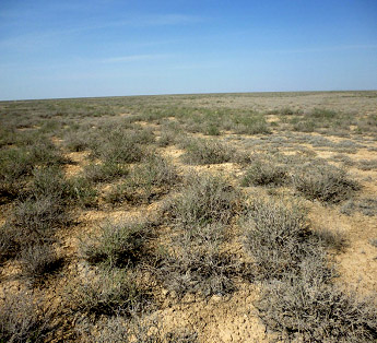
Geobotanical studies initiated in 1979 in the Amu Darya Delta using  route observations and  topo-ecological profiles crossing the main elements of the delta relief (riverine ramparts, their slopes and inter-river depressions) were repeated in monitoring mode in 1985, 1993 and 1999. Route observations conducted in 2017 showed that the modern period of vegetation dynamics is the formation of desert-type plant communities. On most of the territory of the undeveloped delta, which turned into a wasteland after the death of reed (Phragmites australis (Cav.) Trin. ex Steud.) communities (1970-1980), there is an active settlement of the black saxaul (Haloxylon aphyllum (Minkw.) Iljin), encountered for the first time in the Muynak district in 1993. The desert species teresken gray (Krasheninnikovia ceratoides (L.) Gueldenst.), which settled around the same years in the degrading tugai and sparse monocenoses of the tree-like salsola (Salsola dendroides Pall.) on the salt marshes, formed extensive thickets to the north of Kungrad.

Observations on topo-ecological helped to describe trends of particular shifts and stages more detailed. On the right bank of the Akdarya channel, feeding the Mezhdurechensk reservoir, on the topo-ecological profile of Porlytau, 3 km southwest of the hill of the same name, for almost 40 years of observations, the river washed away a section of the riverbed floodplain and the riverbed shaft 500 m wide and eroded 9 m of banks – the level of the eastern part of the Big Sea – fell by 26 m. Vegetation changes are slowly developed. The succession is as follows: from woody sucker-poplar taut (Populus ariana+Populus pruinosa+Elaeagnus angustifolia-Mixteherbosa) through shrubby with tamarix multi-branched (Tamarix ramosissima Ledeb.) and finally to catastrophic change in the nearby site of the interrustal depression – the death of the karabarak (Halostachys belangeriana (Moq.) Botsch.) community. This plant community was formed in 1985 as a result of salinization of the soil on the site of dead reeds. In 2017 the process of slow surface soil desalination which began in 1993 continued in all points of the profile by the irradiation of salts from the upper horizons (0-10 cm) to the lower ones. On the outskirts of Tugai in 2017, for the first time, the presence of a desert species of teresken gray was noted, which possibly will settle throughout this area.

In the north-east of the delta, on the topo-ecological profile of the Kunyadarya, starting on the right bank of the dry channel of the same name and descending in a south-easterly direction to the coastal plain, the degrading Chingil-turang tugai on the riverbed shaft is replaced by tamarix, as evidenced by the species composition of the described community Populus diversifolia-Tamarix laxa+Halimodendron halodendron+ T. ramosissima-Atriplex tatarica. In the community of tall, well-developed tamarix and salt plants located further along the profile on the slope of the riverbed shaft, a black saxaul was first detected in 2017. Then the profile goes to the coastal salt flat Halostachys belangeriana-Climacoptera aralensis community. The salt profiles of soils under all plant communities have similarities : the maximum salt content falls on the upper part of the profile 0-10 cm, it sharply decreases in the horizon 10-20 cm and further to a depth of 50 cm remains unchanged. The salt profiles of the soils under the two sections of the tugai have the greatest similarity. The uppermost horizon of 0-5 cm is less saline or somewhat washed from salts than the deeper horizon of 5-10 cm with the maximum salt content. In the community of Karabarak, the maximum salt content (8.28%) is in the surface horizon of the soil 0-5 cm and sharply decreases to the horizon of 10-20 cm to 2% and decreases to almost 1%. The salt profile under the tamarix communities differs from the rest in that it is all slightly saline and has two maxima – surface weak salinity (0-5 cm – 0.5%) and average salinity (0.8%) at a depth of 20-30 cm. The salt profiles of soils on the topo-ecological profile of Kunyadarya indicate progressive salinization of soils with a pronounced surface-accumulative profile under the influence of pulsating secondary hydromorphism of this site, provoked by the periodically appearing flow of water from the Gulf of Dzhiltyrbas towards the sea.

In 2017 a newly formed young tree tugai was described in a small area on the bank of the irrigation canal crossing the degraded tugai Yerkin. It differs from the degraded ones described earlier : its full–fledged structure has 3 levels, and the richness of the species composition of plants consists of 12 species. Two types of lianas, undergrowth and renewal of woody dominant species of the community are noted. The soil under the young tugai is alluvial-meadow-tugai (hydromorphic), slightly saline (0.36%) only in the near-surface horizon of 0-5 cm.

Comparison of the data obtained on topo-ecological profiles with the data of previous observations, allowed us to assume that the change of plant communities in the conditions of desertification of the unused part of the delta in the communities of woody tugai is mainly successional. At the same time grass and shrub communities, especially their halophilic variants, are changing catastrophically. After they disappear  non-overgrown wastelands are formed for a long time. Conditions for the introduction of species with opposite ecology are prepared.

In local hydromorphic conditions with the floodplain water regime the formation and existence of tugai-type plant communities is possible. As a result the diversity of environmental conditions were characterize and modern processes occurring in the vegetation and landscapes of the unused part of the Amu Darya Delta are detected. These results are useful for organizing and conducting of natural resources use and biodiversity conservation.

Keywords: Uzbekistan, the Republic of Karakalpakstan, used and unused lands of the Amu Darya delta, desertification, hydromorphic, semi-hydromorphic, automorphic stages, topo-ecological profiles, observations, hologenesis, endo-ecogenetic successions, catastrophic and successional changes of vegetation, salt profile of soils, salinization and desalination of soils.

Acknowledgements. Auhors are grateful to M.V. Konyushkova, PhD in Agricultural Sciences, for her assistance in organizing and conducting field work in 2017, processing and analyzing soil data.

Funding. The expedition work was carried out with the financial support of the Regional Representative Office of the International Center for Agricultural Research in Arid Regions – ICARDA, Tashkent (project manager K. Toderich), the analysis of materials and the writing of the article was carried out within the framework of the topic no. FMWZ-2022-0002 of the state task of the Institute of Water Problems of the Russian Academy of Sciences «Research of geoecological processes in hydrological systems of land, formation of surface and groundwater quality, problems of water resources management and water use in the conditions of climate change and anthropogenic impacts».

DOI: 10.24412/1993-3916-2023-4-4-20

EDN: BXJHWA

MINERALOGICAL AND MATERIAL COMPOSITIONS OF SANDS AND SANDY SOILS IN THE CAINOZOIC DEPRESSIONS OF TRANSBAIKAL REGION

Arid Ecosystems

UDC 631.48

Ubugunova V.I., Ubugunov VL., Varlamov E.B., Bazha S.N., Ubugunov L.L. MINERALOGICAL AND MATERIAL COMPOSITIONS OF SANDS AND SANDY SOILS IN THE CAINOZOIC DEPRESSIONS OF TRANSBAIKAL REGION // Arid Ecosystems. 2023. Vol. 29. № 4 (97). P. 81-92. | PDF

 Characteristic of climatic, lithological and geomorphological conditions of formation of sandy soils of Transbaikal Region (Barguzin basin) is given. Main pedogenic processes were found to be cryo- and light-humus, accumulative-carbonate, and fawn-metamorphic. The processes of stratification and abrasion are expressed in soils of fallow lands. Moving sands are not involved in soil formation, but embryonic underdeveloped soils (layered-eolian, humus psammozems) have begun to develop with partial fixation of herbaceous and/or shrub vegetation. Composition of the rocks of the Angara-Vitim batholith, soil-forming sand, as well as the composition of minerals of fractions <1, 1-5 and >5 µm in cryo-humus and light-humus soils are presented for the first time. The regional features of parent sands have been determined to be carbonation, alkalinity and polymineral content, proceeded from the calcic-alkaline rocks. Sandy and silty soil fractions are of similar mineralogical composition with a high content of plagioclases and K-feldspars, and a low quartz amount. The silty fraction is composed by a mixed-layerd phase of illite-smectites interlayered with a single chlorite packets, di-three-octaedric illite, ferruginous chlorite, and kaolinite. Current soil formation is characterized by a low degree of chemical weathering (CIA, CIW, GM) and weak profile differentiation. An increased content of potassium and sodium are the feature of the material composition of sandy soils. Soils under the study correspond to the category of high-alkaline according to the values of total alkalinity. Biological activity is clearly distributed down soil profile. It was revealed that sandy soils have a potential risk of desertification with arable use: within the studied area, all arable lands and fallows located there are deflated to varying degrees. More than 70% of the area has been found to belong to very strongly deflated and strongly deflated. In such lands, humus soil layers are blown out, and carbonate horizons and even parent sands are exposed. The exposed middle horizons and sands are not effectively fertile. The yield of agricultural crops on such arable lands is very low. The process of natural restoration of vegetation cover on fallow lands is extremely difficult, and deflation ulcers practically do not overgrow. Alkalinity and carbonation of soil-forming sands are largely inhibited the processes of natural coenoses restoration.

Keywords: sandy soils, texture fractions, mineralogical composition, Transbaikal Region, Barguzin depression, desertification.

Funding. The work was carried out on the topics of state assignments: the Institute of General and Experimental Biology SB RAS «Evolutionary-genetic, biogeochemical and production functions of the soils of the Baikal region as a component of the biosphere, assessment of their resource potential and development of technologies for rational use and protection» (No. 121030100228-4) and the A.N. Severtsev Institute of Problems of Ecology and Evolution RAS «Historical ecology and biogeocenology» (No. 0109-2019-0007), with the support of the V.R. Filippov Buryat State Agricultural Academy (Theme I, Sub-theme I.03).

DOI: 10.24412/1993-3916-2023-4-81-92

EDN: IJOHVA

ON THE NITROGEN BALANCE IN THE SOIL AND VEGETATION COVER OF ARID ECOSYSTEMS IN THE NORTH-WESTERN PRECASPIAN

Arid Ecosystems

UDC 551.509.22 (470.67)

Asvarova T.A., Gasanov G.N., Gadzhiev K.M., Bashirov R.R., Gimbatova K.B., Abdulaeva A.S. ON THE NITROGEN BALANCE IN THE SOIL AND VEGETATION COVER OF ARID ECOSYSTEMS IN THE NORTH-WESTERN PRECASPIAN // Arid Ecosystems. 2023. Vol. 29. № 3 (96). P. 36-45. | PDF

In this article we present the results of studies on the accumulation and translocation of phytomass estimated by blocks of plant matter, nitrogen concentration and nitrogen reserves. We estimated the compensation of the nitrogen balance in light chestnut and meadow-chestnut soils and typical solonchaks in the grass ecosystems of the North-Western Precaspian under the conditions of aridization and desertification.

Keywords: nitrogen, nitrogen reserves, nitrogen balance, phytomass accumulation, plant matter blocks, green mass, rags, felt, aridization, desertification.

Financing. The work was carried for the state task of the Caspian Institute of Biological Resources of the Dagestan Federal Research Center of the Russian Academy of Sciences “Monitoring and Forecasting of Soil Cover Dynamics and Bioproductivity of Landscapes of the Northwestern Caspian and Dagestan Part of the Eastern Caucasus”, Section 2, No. AAAA-A20-120062990014-2 “Bioproductivity of Landscapes and Nitrogen and Carbon Balances in Ecosystems Exposed to Natural-Anthropogenic Transformation of the North-Western Caspian Sea”, Topic 2, No. 122032200273-6.

DOI: 10.24412/1993-3916-2023-3-36-45

EDN: YBSEMS

ABOUT THE REGULARITIES OF THE DEVELOPMENT OF THE SOIL COVER OF THE PODGORNY-PRIMORYE PLAINS OF THE WESTERN CASPIAN SEA

Arid Ecosystems

UDC 631.4

Kotenko M.E., Asgerova D.B., Galimova U.M. ABOUT THE REGULARITIES OF THE DEVELOPMENT OF THE SOIL COVER OF THE PODGORNY-PRIMORYE PLAINS OF THE WESTERN CASPIAN SEA // Arid Ecosystems. 2022. Vol. 28. № 4 (93). P. 55-60. | PDF

The Podgorny-Primorye plains are widespread in arid regions of the world. They are forming in the coastal strip, where the mountains come close to the seashore. Unlike other plains, they consist of three specific elements of the foothill plain: piedmont plain, coastal plain, or coast, and the continental part of the region. In these landscape components, soils and vegetation cover differ significantly, changing the structure of the soil cover.

Keywords: seashore, arid soils, piedmont plain, desertification, salt migration, soil salinization, indicator.

DOI: 10.24412/1993-3916-2022-4-55-60

EDN: XUWQOR

THE CURRENT STATE OF THE SALSOLA ARBUSCULIFORMIS, ANABASIS SALSA PASTURES OF KARAKALPAK USTURT (UZBEKISTAN)

Arid Ecosystems

UDC 581.5 (575.13)

Rakhimova N.K., Rakhimova T. THE CURRENT STATE OF THE SALSOLA ARBUSCULIFORMIS, ANABASIS SALSA PASTURES OF KARAKALPAK USTURT (UZBEKISTAN) // Arid ecosystems. 2022. V.28. № 3 (92). P. 61-71. | PDF

The article is devoted to the study of the current state of pastures of the Chernoboyalyshev-Biyurgun (Anabasis salsa, Salsola arbusculiformis) type, common in the territory of Karakalpak Ustyurt (Uzbekistan). The results of field studies of the species composition and productivity of plant communities with the dominance of Salsola arbusculiformis are presented and the reasons for the difference between the obtained data and the data of Karakalpak researchers of the 1970s are discussed. These pastures cover half of the northern and eastern parts of the territory (1,291,414 ha) and are distributed on gravelly, loamy, takyr-alkaline, gypsum soils of the Karakalpak Ustyurt, which includes 4 pasture varieties: shrub-white-earth wormwood-black boletus (Salsola arbusculiformis, Artemisia terrae- albae, Atraphaxis spinosa, Convolvulus fruticosus) with the participation of zaisan saxaul (Haloxylon ammodendron); white-earth sagebrush-black balsam (Salsola arbusculiformis, Artemisia terrae-albae): a) with the participation of Convolvulus fruticosus, Rheum tataricum, Stipa richteriana; b) with the participation of Anabasis brachiata; biyurgun-black balsam (Salsola arbusculiformis, Anabasis salsa) with zaisan saxaul (Haloxylon ammodendron) and shrubs (Salsola arbusculiformis, Atraphaxis spinosa, Convolvulus fruticosus). The area of the studied pasture varieties, the nature of the soil cover, the percentage of projective cover, landscape plant species, their placement, forage yield and recommended seasonality of use were determined. The composition of the vegetation remains monotonous due to complexes of boyalyshev, biyurgun and wormwood communities. Due to the lack of moisture in the year of observation (2021), the dominant species (Salsola arbusculiformis, Artemisia terrae-albae) showed a weak annual growth (up to 1 cm) and they were in a depressed state. The seasonal forage yield of pastures of the Salsola arbusculiformis, Anabasis salsa pastures ranges from 0.5 to 3.5 q/ha, the maximum yield occurs in the autumn period. According to estimates of the yield of the eatable part (c/ha), the studied pasture varieties are recommended to be used as an autumn-winter pasture.

Keywords: Republic of Karakalpakstan, Ustyurt, desertification, pasture difference, degradation, vegetation cover, productivity.

Financing. The work was carried out within the framework of the State Program (PFI-5) «Assessment of the current state of vegetation cover and pasture resources of the Republic of Karakalpakstan».

DOI: 10.24412/1993-3916-2022-3-61-71

SPECTRAL CHARACTERISTICS OF DESERTIFICATED PASTURES OF BLACK LANDS (KALMYK REPUBLIC)

Arid Ecosystems

UDC 631.1: 631.4:631.6:581.5: 528.7:528.8:574.46

Yuferev V.G., Tkachenko N.A., Sinel’nikova K.P. SPECTRAL CHARACTERISTICS OF DESERTIFICATED PASTURES OF BLACK LANDS (KALMYK REPUBLIC) // Arid ecosystems. 2022. V.28. № 1 (90). P. 65-72. | PDF

Geosystems of the desert territories of Kalmykia in modern conditions function in conditions of increasing anthropogenic impact and intensity of negative weather events, including the impact of dust storms, which often leads to a significant decrease in pasture productivity, a decrease in the feed base and a significant reduction in livestock. In this regard, it is relevant to determine the spectral characteristics of desert pastures by ground methods, which provides not only the detection of the reflected energy distribution over the spectrum frequencies, which in itself is important for subsequent verification of remote sensing data of pastures, but also the possibility of obtaining the values of normalized indicators, both for plant communities and for specific plants and soil types with the formation of a spatial data base. The objects of the study are the natural phytocenoses of desert pastures of the Black Lands at the landfills: «Smushkovo»,  «Molodezhny», «Privolny», «Dl. Sagi» and «Tavn-Gashun». Geobotanical and spectrometric studies were carried out at these polygons and spatially determined data on the spectral characteristics of plant communities were obtained. Spectrometric studies of phytocenoses are carried out to assess their condition on the basis of spectrosonal surveys, both ground-based and remote. To present the results of the assessment of the spectrometric characteristics of the vegetation cover of the downed pastures: the predominant communities at the landfill and «Tavn-Gashun» were selected: bluegrass with Descurania sofia (Poa bulbosa+Descurainia sophia) with a projective cover of 45%, grasshopper bluegrass (Poa bulbosa-Stipa capillata) – with a projective cover of 40% and open soil (slightly humus sand). The studies were carried out using the PSR-1100 field spectroradiometer. The results of studies of the spectrum of reflected radiation of plant communities and underlying soils allowed us to establish the characteristic features of the distribution of reflected and absorbed energy, to compile a catalog of individual spectra and normalized indicators for them. Individual spectral characteristics were established for the phytocenosis Poa bulbosa+Descurainia sophia, the average value of reflected energy in all spectral ranges is 20.2 MW/(m2×sr×nm), the standard deviation of reflected energy is 9.90, the vegetation index NDVI = 0.208, for Stipa capillata, the average value of reflected energy in all spectral ranges is 20.5 MW/(m2 sr nm), the standard deviation of reflected energy is 12.36, the vegetation index NDVI = 0.316, for Calligonum aphyllum, the average value of reflected energy-the reflected energy in all spectral ranges is 47.2 MW/(m2×sr×nm), the standard deviation of reflected energy is 9.81, the vegetation index NDVI = 0.354. For soil, the average value of reflected energy in all spectral ranges is 30.3 MW/(m2×sr×nm), the standard deviation of reflected energy is 9.28, the vegetation index NDVI = 0.106. The highest average value of NDVI was noted for Calligonum aphyllum.

Keywords: geosystem, analysis, desertification, degradation, spectrometry, satellite images, phytocenoses, verification, vegetation indices, albedo.

Financing. The work was carried out within the framework of the State Task of the Federal Research Center of Agroecology of the Russian Academy of Sciences No. 0713-2019-0001 “To conduct theoretical and geoinformation modeling, monitoring, forecasting of degradation processes of components of agroforestry landscapes based on aerospace research in forest-steppe, steppe and desert zones and to develop ways to manage anti-degradation agroforestry technologies to prevent desertification of lands, increase their fertility and form an ecological framework” (state registration No. AAAAAA-A-116122010038-9).

DOI: 10.24412/1993-3916-2022-1-65-72

Навигация по записям

← Предыдущие записи

About the Journal

  • General Information
  • Open Access 
  • Preprint
  • Topics of the journal
  • Editoral Board
  • Editorial Policy
  • Editorial Ethics

Articles Supplying

  • Rules of Manuscripts Supplying
  • Articles Design
  • Article Structure
  • Guidens for Writing an Article
  • Articles Translation

Review of manuscripts

  • Review of manuscripts

Archive

  • 1990s editions
  • 2000s editions
  • 2010s editions
  • 2020s editions
    • Issues for 2020
    • Issues for 2021
    • Issues for 2022
    • Issues for 2023
    • Issues for 2024
    • Issues for 2025
  • Events

_______________________

©2026 - Arid Ecosystems - Weaver Xtreme Theme
↑